Stacks of swell, just gotta work around the wind

South Arm Surf Forecast by Ben Matson (issued Wednesday April 24th)
Features of the Forecast (tl;dr)
- Strong surf Thurs, a little wind affected at exposed spots
- Very strong surf Fri with lighter winds, possily small waves along the regional points
- Great waves this weekend with light N'ly winds both days and easing surf, strong initially Sat AM
- Another decent swell next Tues, tho' probably wind affected
Recap
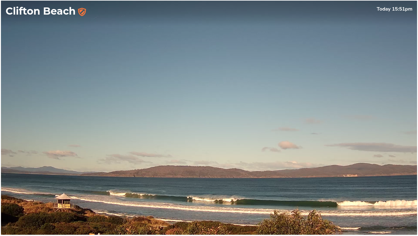
Small surf has slowly built from late Tuesday through today, with sets now pushing 3-4ft under fresh W’ly winds (see image below from Clifton this afternoon). For the record, Maatsuyker Island’s been gusting 55kts this afternoon (102km/hr), though wind speeds have been considerable lighter inside Storm Bay.
(Please note: FC Notes will be variable in delivery this week as Craig is on paternity leave)
This week (April 25 - 26)
No change to the outlook for the next few days.
Similar conditions will persist on Thursday under fresh W’ly winds, however they’ll ease back considerably into Friday morning and we should see early W/NW winds.
Size wise, a continuation of today’s swell will hang around into Thursday so most open beaches should manage 3-4ft sets. Late in the day (and more so overnight) a new long period S/SW swell will push through, generated by another polar low developing south of the continent over the last day or so.
This fetch is much better positioned for the South Arm due to the more eastern position of the storm track, so exposed locations are likely to increase into the 4-6ft range, showing best early Friday morning, easing slowly into the afternoon. This should allow enough size for small peelers across the regional points.
This weekend (Apr 27 - 28)
Easing surf is expected over the weekend with light northerly winds keeping surface conditions clean both days. Saturday will see the biggest waves with early 3-4ft sets easing to 2-3ft, Sunday will level out around 2ft+ and most breaks should have something worthwhile. It’s a really good weekend to get out and about to find some quality surf.
Next week (Apr 29 onwards)
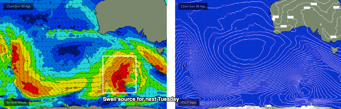
A strong polar low and front will develop well SW of the continent on Thursday and Friday, and power through our swell window over the weekend (see below), generating a powerful new groundswell that will arrive on Tuesday morning, and build to 3-4ft. I'm a little concerned that this system may develop towards the western periphery of our swell window, and the resulting swell direction may consequently have too much west, but overall it's a nice looking synoptic chart that should produce something worthwhile.
As is often the case with these swells, we’ll see gusty SW winds accompanying, but we’ll fine tune the specifics on Friday’s forecast to see if there are any windows of opportunity.
See you then!