Spring In Review

Spring has come and gone, and with it the memories of a mixed season - your fortunes largely depending upon where you live.
For Victoria's Surf Coast, a dynamic winter showed signs of continuing into spring only to have many promising swells cruelled by wind. So instead of corduroy, a less organised, more wind affected season unfolded.
The East Coast was the opposite. A dreadful winter across most of southern NSW - the worst in recent memory for some locations - improved considerably with the arrival of swells from a more eastern direction along with favourable winds.
After almost a year of heavy sand build up, beaches again started to develop gutters and semi-stable banks which lit up under a couple of memorable east-northeast groundswells. Not forgetting a couple of larger, long-period southerly groundswells as well.
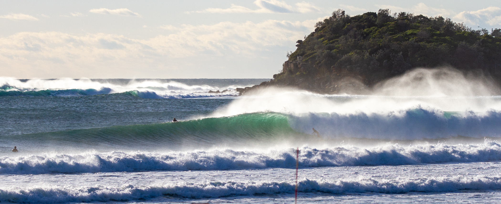
Spring perfection (Brokensha)
Further north, the southerly swells didn't make as much of an impact in northern NSW, but back to back easterly swell events provided some of the best surf of the year, while south-east Queensland provided smaller, weaker swells mostly under the influence of northerly winds.
Still, it hardly went flat, unlike many springs seasons.
Western Australia was very slow and hot. A semi-stationary heat-trough sitting along the coast, with high pressure to the south put a block on Southern Ocean frontal activity while drawing in record-breaking heat from inland.
Victoria/South Australia fell somewhere in between the East Coast's active spring and the benign conditions to the west. The only issues were persistent winds from the south, owing to a stubborn high pressure sitting under Western Australia and through the Bight. This limited options to more protected breaks.
The general spring summary can be see in the Mean Sea Level Pressure anomaly charts (difference from long term climate average) below.

Mean Sea Level Pressure anomaly for spring (Sep/Oct/Nov) (NOAA)
The high pressure anomaly extending from the south-west of Western Australian, through the Bight and to Tasmania shows the blocking mechanism well. The low pressure heat-trough on the Western Australian coast is also clear along with the inland trough through Queensland, New South Wales, and Victoria, which fed moisture to locations west of the divide.
High pressure was notable in the Tasman Sea, but small depressions to the north of New Zealand and kinking in towards Tasmania point to the sources of east and south swell.
October was the most active month of surf for the East Coast and the MSLP anomaly charts for this month alone show the sources of swell in more detail below. That being the low pressure depression just east of Tasmania, low off New Zealand and stronger anomaly to the south, feeding cooler southerly winds and swell.

Mean Sea Level Pressure anomaly for October (NOAA)
The final chart is the mean wind anomaly for the past three months, with the onshore southerly flow evident for Victoria and South Australia, the heat-bearing easterly winds across Western Australia, and in the far upper left corner, stronger than normal south-east trade winds linked to the strong positive Indian Ocean Dipole event.

Mean wind direction and speed anomaly for spring (Sep/Oct/Nov) (NOAA)
Moving into summer, waters surrounding Australia are warmer than during any other strong El Niño, so it'll be an interesting few months ahead weather and swell wise.
Comments
early messy cyclone any thoughts Craig
Could be a best case heading up into the central Qld coast, saving banks further down in the more surfable regions.
It'll mean average surf though with onshore winds from the north-eastern quadrant feeding into Jasper.
cheers couple of different models for tracking unknown is if it feeds of warm water in the coral sea
A slightly better than average Spring here.
The usual weeks of howling Northerlies left us mostly alone.
Standard El Nino Spring in Cooly
one of the worst springs in living memory for Surf Coast
Agreed, fucking abysmall
The pits!
imagine how hectic its going to be once we get a half decent day. be a clusterfuck
What the hell is all that high pressure doing in the southern ocean?
Dragging more superheated air down to the Antarctic looks wrong
One of the worst springs in living memory for upper SW WA. (On top of one of the worst winters, autumns, Summer, ..rinse and repeat.). Abysmal last couple of years to be honest!
Yeah it looked dire, and after a poor winter (which are usually expected).
We actually all look forward to winter on this upper part of the SW coast, as unlike down south we get many offshore mornings with swell.. but this winter there were hardly any storms to smash up the sandbanks and hardly any decent groundswells! What ones there were it was onshore.