Great outlook continues for exposed WA coasts

Western Australia Surf Forecast by Ben Matson (issued Friday April 24th)
Features of the Forecast (tl;dr)
- Strong new swell showing in Margs Sat PM, peaking Sun AM, with good winds
- Small waves at exposed metro beaches on Sun
- Size slowly easing Mon onwards, with good winds most of the week
- Large long period swell arriving Fri, peaking Sat, easing Sun, with good winds
Recap
The groundswell event expected late Thurs/Fri came in well under budget and a long way behind schedule (sorry!). We’ve seen some 4ft sets throughout the Margs region this afternoon and conditions have been clean but it’s certainly nowhere near what was expected. Metro beaches have remained tiny for the most part, with occasional 1ft sets showing at the swell magnets this afternoon, and conditions have been clean with favourable winds.
This weekend (Apr 27 - 28)
The next groundswell event is still on target for the weekend, however I’m now a little cautious on prospective wave heights, based on today’s significant underperformance.
Even though this is a new swell event generated by a separate fetch, it has originated from a similar part of the distant swell window - and most of this energy was aimed into Indonesia.
West Oz will be somewhat on the boundary of the fetch alignment, receiving peripheral sideband swells.
So, let’s pull things back a notch and be pleasantly surprised if they exceed expectations, eh?
The leading edge should nose into the coast early Saturday, with a noticeable upkick showing by lunchtime, and the swell starting to show some muscle late in the day, ahead of a peak on Sunday morning. I’ll peg most breaks around the 4-5ft mark but expect some deepwater reefs to push 6ft+ at the height of the swell.
Saturday’s winds look iffy anyway with lingering onshore winds spoiling conditions (more so south from Margs, it’ll be better in the north towards Cape Nat). Sunday looks reasonably good with early light SE winds becoming fresh through the day as a new high pressure system ridges in winds may go S/SE into the afternoon).
Metro beaches won’t see much of a size increase on Saturday - maybe some small waves at the swell magnets late afternoon - but Sunday’s shaping up to offer fun small waves in the 1-2ft+ range across exposed Perth beaches, and 2ft, occ 2-3ft in Mandurah.
Next week (Apr 29 onwards)
The first half of next week looks great for Margaret River with steady easterly winds and slowly easing swells from Sunday’s peak. Monday morning will have the most size with 4-5ft sets at exposed spots, down from 3-4ft to 2-3ft Tuesday and then from 2-3ft to 2ft on Wednesday.
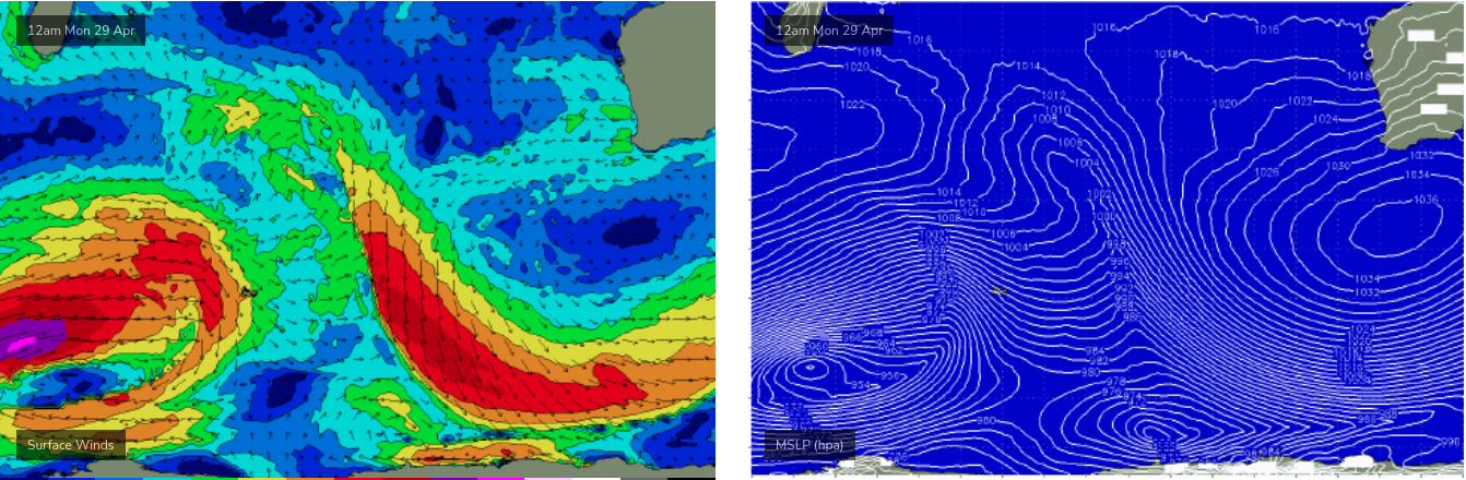
This weekend, a major swell generating machine will develop south of Madagascar (see below), and push powerful long period swells towards WA, arriving late Thursday and into Friday (peak periods of 22 seconds!). This swell will again be best aimed towards Indonesia, but we’re looking at some excellent waves for Friday afternoon and Saturday that could push the 8-10ft mark at offshore bombies in the lower south-west. Size will then ease slowly from Sunday.
Current expectations are that conditions will be nice and clean with favourable winds.
Craig will have more on this in Monday’s update.
Have a great weekend!