Quality period of waves ahead for the lower south-west

Western Australia Surf Forecast by Ben Matson (issued Monday April 22nd)
Features of the Forecast (tl;dr)
- Today's solid swell easing throughout Margs on Tues/Wed with generally good winds
- Metro beaches looking best for small waves on Tues
- Another decent groundswell Thurs/Fri with favourable winds
- Yet another groundswell for the weekend, winds look OK at this stage
Recap
Saturday’s surf came in a little undercooked across all coasts, wth 3-4ft sets in the southwest and 1-1.5ft across metro beaches. Sunday however delivered excellent surf peaking around 6-8ft throughout Margaret River and 2-3ft in Perth with the odd bigger set in Mandurah, with perfectly clean conditions thanks to almost all-day light winds. A slightly stronger swell filled in today across Margaret River (which looks a smidge smaller on metro coasts, compared to yesterday) however winds are gusty from the south so conditions are considerably more wind affected.
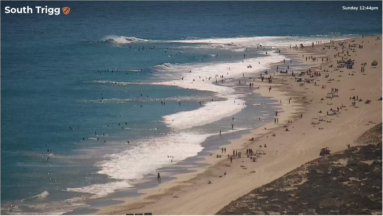
Triggs showing fun options around lunchtime Sunday
(Please note: FC Notes will be variable in delivery this week as Craig is on paternity leave)
This week (April 23 - 26)
Today’s solid swell will hold through early Tuesday morning before easing during the day and continuing its downward trend into Wednesday.
Local conditions should improve across the Margs region as winds veer more E/SE through the morning, though they will probably back to the SE or even S/SE into the afternoon. Early 6-8ft sets will lose two or three feet as the day wears on, bottoming out a 3-5ft on Wednesday under cleaner conditions as the wind swings straight easterly and holds for most of the day.
Across metro beaches, we’ll see a similar swell trend easing from 2ft+ across the Perth region (bigger in Mandurah) but by Wednesday it’ll start to become borderline surfable around 1-2ft at the swlel magnets and tiny elsewhere.
Morning offshores will keep conditions clean; at this stage there’s no suggestion for afternoon sea breezes due to the strength of the synoptic breeze - meaning conditions should remain favourable all day.
Thursday and Friday look really nice with a new swell originating from a strong polar low and front currently pushing south of Heard Island. It's a distant storm so the sets will be inconsistent but wave heights should reach a peak in the 6ft+ range throughout Margaret River on Thursday afternoon (smaller earlier), 1-2ft at reliable swell magnets in Perth and a little bigger in Mandurah, easing from a similar size early Friday.
Local conditions look great both mornings with light offshore winds but a weaker pressure gradient means we’ll be susceptible to afternoon sea breezes these days.
This weekend (Apr 27 - 28)
A powerful but distant polar low below Madagascar right now is generating a new long period swell for the weekend.
Current expectations are for solid 5-6ft sets from this source but I have a feeling that the longer periods will result in bigger waves at a few reefs, nudging 6-8ft - though they will be extremely inconsistent.
Metro beaches should pick up small, infrequent 1-2ft sets from this swell.
Conditions look reasonably good everywhere at this stage but a new high pressure system ridging in from the west will probably freshen the breeze from the SE at some point. I’ll firm up the details as the week progresses.
Next week (Apr 29 onwards)
Nothing major on the boil for next week at the moment.