Fun weekend for the beachies, nice waves on the way for mid-late next week too

South Arm Surf Forecast by Ben Matson (issued Wednesday April 24th)
Features of the Forecast (tl;dr)
- Fun waves all weekend with light winds and slowly easing size
- Another solid swell Tues but onshore winds will create bumpy conditions
- Better surf mid-late week with easing onshore winds and another pulse of stronger surf around Thurs
Recap
Strong surf Thursday with moderate cross-shore winds from the west, with the breeze easing today as the swell muscled up a little more.
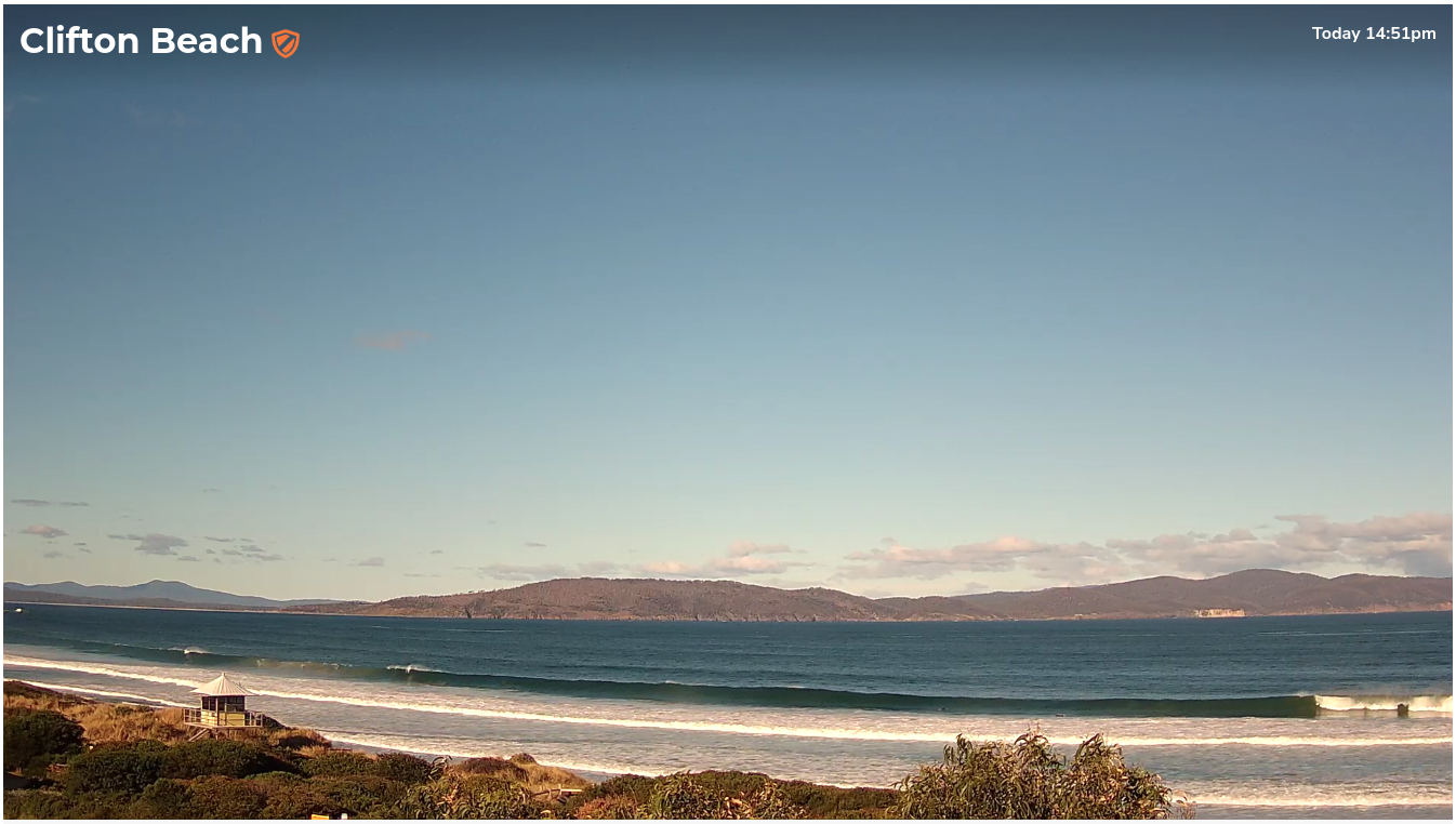
Solid lines this afternoon
This weekend (Apr 27 - 28)
No change to the weekend outlook, with clean conditions both days - light northerly winds Saturday freshening a little into Sunday ahead of a more significant strengthening later in the day and overnight into Monday.
Surf size will however be easing for the entire weekend. Rare 3-4ft sets at exposed beaches early Saturday morning will abate to 2-3ft by lunchtime, though should maintain 2-3ft into Sunday morning before easing a little more throughout the day.
All in all, it’s shaping up to be a great weekend for most of the exposed South Arm locations, so get out and into it.
Next week (Apr 29 onwards)
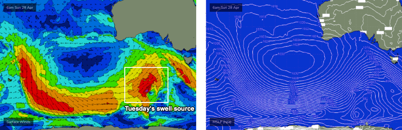
A new groundswell is expected early next week, sourced from a polar low currently midway between Heard Island and West Oz longitudes, which will strengthen south of the continent over the weekend and push up through our SW swell window (see below).
The latest model runs have eased back its strength a touch and also pushed it slightly to the west and north of our swell window, so I’m going to temper wave height estimates a little, however we should see surf size building towards 3ft along exposed South Arm locations on Tuesday.
Monday will kick off with small leftovers from the weekend and a mid-morning W’ly tending W/SW change that will blow out exposed beaches (as wave heights build after lunch).
Tuesday’s swell peak will be accompanied by moderate to fresh SW winds though they should be lighter and more W’ly early.
A series of secondary polar fronts trailing behind will maintain 2-3ft surf through Wednesday and Thursday, with easing onshore winds becoming light, and allowing surface conditions to clean up. In fact, Thursday is on target for a pulse of long period energy from a strong fetch at the tail end of this system that could generate some 4ft sets throughout the day.
The long term outlook has some incredible looking storm systems way out in our distant swell window (south of Madagascar) that will deliver incredible waves for the Indo region, but will probably be too far away from our coast to really light things up. The associated long period energy (22 seconds!) from those early developments are due to arrive next weekend but we’ll be relying on future storm activity closer to our region - not yet locked in on the models right now - to offer any appreciable size.
Craig is back on deck Monday, he’ll have more details on that then.
Have a great weekend!