Plenty of east swell ahead, good conditions in the north

South-east Queensland and Northern NSW Surf Forecast by Ben Matson (issued Wed Dec 20)
Features of the Forecast (tl;dr)
- Building trade swell Thurs, peaking Fri PM/Sat AM, easing through the weekend
- Peaky SE swell for the MNC on Friday, easing Sat
- Generally variable winds north from Byron Thurs thru' Mon
- Fresh S'ly winds a risk on the MNC Thurs, maybe nosing into Yamba Fri, and potentially Northern Rivers overnight into Sat, but then easing during Sat
Recap
Tuesday offered small levels of east swell and light winds that freshened from the north throughout the day. Today has seen the trade swell muscle up a little throughout SE Qld and Far Northern NSW (odd 2-3ft sets at the swell magnets) and a window of light morning winds allowed the initially small surf to be quite fun. Northerlies are now up across most regions. The Mid North Coast has seen an additional NE windswell in the mix today.
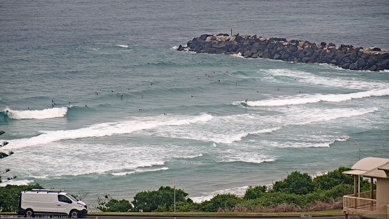
D'Bah late Wed afternoon
This week (Dec 21 - 22)
We’ve got building trade swells for the next few days, and a weakening synoptic pattern in the north, that will result in light variable winds and sea breezes in most northern areas.
Note: ‘variable’ means ‘from any direction’, which may be onshore at times - but I’m not expecting any strength on Thursday north from about Byron Bay.
However, the Mid North Coast is an outlier to this wind outlook.
A small surface low is expected to form at the tail end of a broad trough stretching the length of the East Coast (the low will develop east of Eden). This will push southerly winds across Southern NSW, and they’ll nose into the lower Mid North Coast on Thursday, strengthening a little more into Friday with its influence probably felt up to about Yamba (some model guidance pushes even further north, though I feel this may not happen until overnight Friday, into Saturday).
Either way, everywhere north from Byron should expect generally variable winds for the next few days, but if you’re located to the south, expect S/SW winds at some point - definitely on the Mid North Coast both days, and possibly a little further north into Friday.
As for swell, the trade swell should build slowly Thursday, plateauing Friday and Saturday then easing Sunday. But in the middle of this pattern we’ll see a brief period - late Friday through early Saturday - where wave heights are likely to punch a little higher, thanks to an E’ly dip forming near New Caledonia today that's now tracking south. It'll enhance the pre-existing easterly energy with a little more size and strength, from what's otherwise expected to be an otherwise bog-standard easterly trade swell.
This should push SE Qld up from a general peak of 2-3ft up in the 3ft, almost 3-4ft range at the swell magnets. Northern NSW should fare a little better, generally 3-4ft at most open beaches but pushing 3-5ft at the regional swell magnets late Friday and early Saturday.
Also in the mix on Friday (mainly the Mid North Coast) will be a spread of SE swell from the developing low along the trough line (down south). Beaches picking up the bulk size from this source will be wind affected, but it should be worth 3-4ft sets south from Coffs (smaller to the north).
All in all, plenty of surf - just gotta work around the winds.
This weekend (23 - 24)
Lingering S’ly winds on Saturday will probably veer SW for a few hours early morning across most coasts, then tend moderate S’ly through the day.
An approaching trough on Sunday will then freshen early light winds around to the NW - mainly across SE Qld - though there’s a risk for a return SE flow as the trough crosses the coast into the afternoon. Confidence is low on this scenario right now so check back on Friday.
As for surf, Friday’s late peak from all swell sources (east and south-east) will hold through Saturday morning before easing through the day, and further into Sunday. If anything, we may see the east swell peak earlier across SE Qld (i.e. Friday night) so expect the easing trend to already be on the way down from Saturday morning.
Overall, swell is not so much of an issue for the weekend, I’m just a little hazy on the wind specifics.
Let’s tighten that up in Friday’s notes.
Next week (Dec 25 onwards)
Complex coastal troughs are still on the agenda for next week.
Model guidance is quite mixed on specifics, but the broad synoptic trends are in agreement so despite nothing to pin down specifically - except a slow start on Monday - we’re looking at plenty of waves throughout next week.
Unfortunately, it also looks like we may be in for a spell of northerly winds too. However there will be pockets of opportunity (as well as some unusual short range N’ly swell to capitalise on)
Let’s leave it a few more days to see how the models consolidate, so we can start to plan a more effective use of our time.
See you Friday!
Comments
This morning +1ft is all we need... more's always nice though.
Surfed some super fun, clean (albeit a bit of wobble on the swell) 2ft/2ft+ waves at a SC beachie this morning. Had a peak just to myself for most of it and it was super fun before the tide turned and hence turned off the sets.
Twas nice to actually surf in some warm water for a change!!
Really trying to pick up this morning - 2ft with the occ. 3ft set.
Had a little wobble with the morning rain, cleaned up with a variable/offshore flow that coincided with a dropping tide which helped pull the sheets tight.
I'm on the Goldy and the open beaches are now slightly overhead. Winds are up from the south. Lots of big rainbearing cells around too.
Took longer to clean up today, a touch more energy and more consistent, but lucky to see 3ft yet. I'd love a solid 4ft close out right now, it's been so small for so long.
What’s the source of the 15-18sec period stuff showing on the multispectral buoys?
Definitely up a notch this morning.
Holy hell, there's some froth in the crowd too.
Cold, green water, fresh S'ly.
Did not feel like the Summer Solstice.
Clean 3ft+ sets on the Tweed though limited options under the southerly. Swell seems very slow too. Looking forward to the arvo kick in strength.
waited a bit till the froth wore of and had some solitude on central beachies after 8:30 this morning. a little slow, but super fun and surprisingly clean for a south wind! happy days
Lucky to be 3ft so far.
some fun waves at burleigh..1st surf in 3 months due to shoulder reconstruction. fun waves to start back with.
has a quick paddle just up the beach from the point RK, on the way to tweed to pick a new board, did a lap of cooly the boarder beach looked really nice heavily crowded.