Into next week and a large blocking high moving into the Tasman over the weekend is now weaker than expected and the resultant trade flow through the Coral Sea is also much weaker.
Therefore we’re now only looking at tiny surf for next week
Primary tabs
/reports/forecaster-notes/central-queensland/2023/11/17/small-surf-the-weekend-downgraded-outlook
freeride76
Friday, 17 November 2023
/reports/forecaster-notes/central-queensland/2023/11/15/not-much-week-small-pulse-swell-tc-mal-the
freeride76
Wednesday, 15 November 2023
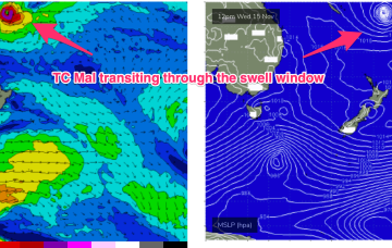
In addition a quick pulse of E/SE swell from TC Mal as it races through the swell window is expected Sat into with some 2ft sets.
/reports/forecaster-notes/central-queensland/2023/11/13/small-fun-tradewind-swell-slowly-eases-week
freeride76
Monday, 13 November 2023
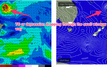
In the tropical South Pacific an area of convection is currently organising and deepening into a tropical depression and potential TC east of the Solomon Islands. This depression or TC is expected to race through the swell window and send a small pulse of swell our way.
/reports/forecaster-notes/central-queensland/2023/11/08/fun-tradewind-swell-slowly-eases-next-week
freeride76
Wednesday, 8 November 2023
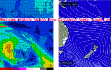
No great change to the f/cast. A large (1030hPa) high near New Zealand is continuing to direct tradewinds through the Coral Sea, with the New Caledonia region being the strongest wind area.
/reports/forecaster-notes/central-queensland/2023/11/06/fun-tradewind-swell-episode-ahead
freeride76
Monday, 6 November 2023
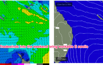
A slowly developing tradewind flow in the Coral Sea will see a small E’ly swell signal become workable through the week, with signs we’ll see a perk up in size late this weekend and early next week.
/reports/forecaster-notes/central-queensland/2023/11/03/ely-tradewind-swell-ahoy
freeride76
Friday, 3 November 2023
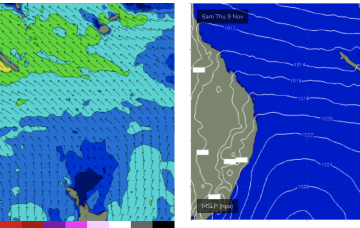
Once the tradewind flow sets up early next week as the blocking high enters the Tasman we should start to see an increase in tradewind swell, likely by Tues at the latest.
/reports/forecaster-notes/central-queensland/2023/10/30/tiny-swells-over-the-weekend-some-small-ely
freeride76
Monday, 30 October 2023
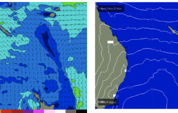
As the strong high moves E of Tasmania on Sun we'll see tradewinds start to build across the Coral Sea.
/reports/forecaster-notes/central-queensland/2023/10/27/small-round-surf-weekend
freeride76
Friday, 27 October 2023
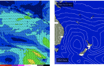
This swell energy isn’t well aimed for for CQ but the developing surface low is still strong enough to send swell north of Fraser Island.
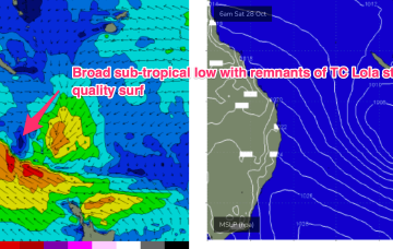
/reports/forecaster-notes/central-queensland/2023/10/23/small-surfable-weekend
freeride76
Monday, 23 October 2023
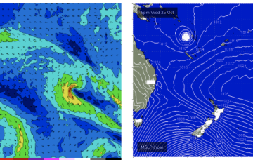
The expected strong SE surge is captured by a trough and deepens into a surface low on Fri with small SE swell expected for the weekend in the 2ft range under fresh/strong S/SE winds.
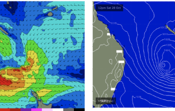
/reports/forecaster-notes/central-queensland/2023/10/20/small-over-the-weekend-hope-the-horizon-0
freeride76
Friday, 20 October 2023
Much better odds for surf as a strong SE surge builds up the coast Fri, with a broad SE fetch in the Coral Sea over next weekend and into early next week. That should see rideable surf develop Fri and hold in the fun-sized range into the weekend and potentially early week after.